
Traditional industrial inspections put people in dangerous positions. Inspectors climb scaffolding on exposed rooftops, rig rope access systems on bridge structures, and squeeze into confined spaces just to gather visual data that could be captured from the air in an afternoon. Drone surveys remove the need for inspectors to work at height, capturing visual and geospatial data safely from the air, and they cut the cost and timeline while doing it. The risk is real under the old model; UAV surveys have changed the equation on all three fronts.
This guide covers how aerial survey technology actually works, which industries are getting the most value from it, what a fair price looks like in 2026, and what credentials to verify before you hand a contract to any provider. Some contractors now integrate drone surveys into wider maintenance programmes so that findings trigger action rather than sitting in a folder. By the end of this guide, you’ll know which survey type fits your asset, what deliverables to insist on, and how to evaluate any provider you’re considering.

How do drone surveys actually work?
UAV surveys are not a single technology. They’re a category that covers several distinct capture methods, each suited to different asset types and output requirements. Treating them as interchangeable is how buyers end up with the wrong data format and a frustrating rework conversation with their surveyor.
Drone surveys: capture methods explained
Photogrammetry uses overlapping aerial images to build georeferenced orthomosaics, digital surface models (DSMs), and digital terrain models (DTMs). The key accuracy metric is ground sample distance (GSD): the smaller the GSD, the finer the detail captured per pixel. Ground control points (GCPs) anchored at known coordinates are what push horizontal accuracy down to the centimetre level. This method works best over open terrain, textured surfaces, and large-area mapping where visual realism matters alongside geometric precision.
One important limitation: horizontal accuracy typically outperforms vertical in photogrammetric workflows. Vertical error can be two to three times worse than horizontal in some setups. That matters when you’re feeding results into CAD or GIS systems and making engineering decisions based on elevation data.
LiDAR drone surveys
LiDAR fires laser pulses at the target and measures return times to build dense, calibrated point clouds. The practical advantage over photogrammetry is consistent vertical accuracy, typically 1 to 3 cm, and the ability to capture data through vegetation, in low light, and around complex structures where cameras struggle. Point density ranges from around 50 points per square metre on standard surveys to over 500 points per square metre on low-altitude, slow-speed passes.
LiDAR is the correct choice for elevation-critical projects, forested or overgrown corridors, and complex infrastructure where geometry matters more than texture. It costs more to operate and process than photogrammetry, but on the right asset type, dense vegetation, complex 3D geometry, or tight elevation tolerances, the accuracy gain makes it the preferred option. For a technical comparison of the relative strengths and weaknesses of LiDAR and photogrammetry, see this LiDAR vs photogrammetry overview from an industry perspective: LiDAR vs photogrammetry.
Inspection-grade UAV surveys
Inspection-focused drone work is a different discipline entirely. The goal here is close-range visual capture using HD video, thermal imaging, and high-resolution photography rather than geospatial mapping. This is the method used for commercial drone roof inspections, facade condition surveys, bridge structural assessments, and offshore or wind turbine inspections. Thermal imaging adds a layer of diagnostic capability that visual surveys can’t match: moisture ingress, heat loss through insulation, and electrical faults that are completely invisible to the naked eye all show up clearly on a thermal camera.
Which industries are getting the most value from UAV surveys?
Aerial and UAV-led inspection has moved from a novelty to a primary method in several sectors. These four have shifted their procurement behaviour most clearly.
Construction and civil infrastructure
Construction teams use drone mapping services for site surveys, volumetric calculations, earthworks monitoring, and progress documentation at every stage of a project. The time comparison alone is compelling: a 40-acre topographic drone survey that requires one to two days in the field takes three to four weeks with a traditional ground survey crew. Accuracy is comparable across both methods; the time and cost advantage is not. For developers running tight programme schedules, that difference matters more than any technology specification.
Rail and transport infrastructure
Rail operators face a specific operational constraint: inspections must happen in narrow possession windows with zero tolerance for safety incidents. UAV surveys let inspection teams assess bridges, viaducts, embankments, and trackside structures without placing personnel in live environments. Photogrammetry and thermal imaging are used together for structural monitoring and defect detection between scheduled maintenance intervals, giving asset managers a data record that improves with each inspection cycle rather than starting fresh each time.
Renewables and offshore assets
Wind turbines and offshore platforms are remote, high-risk, and expensive to access by any conventional means. Drone surveys eliminate the need for rope access or scaffold towers for routine visual inspection of turbine blades, nacelles, and platform superstructure. In some programmes, aerial UAV surveys are combined with underwater ROV inspections to cover the asset envelope above and below the waterline. Asset owners in this sector demand detailed thermal and HD video deliverables, not just point cloud data, because maintenance decisions depend on what the inspector can see and interpret, not just on geometry.
Drone surveys vs traditional inspection: cost, safety, and data quality
Most facilities managers considering UAV surveys already suspect they represent better value. The specifics confirm it.
The real cost difference
A commercial roof inspection via drone runs approximately £1,100 to £2,500. The same job using scaffolding adds mobilisation, erection, and hire costs that can multiply the total bill significantly before a single inspector steps onto the platform. Industry comparisons consistently show scaffolding-based access driving costs well above drone equivalents for comparable assets. For larger structures, the gap widens further. UAV surveys also reduce repeat visits because the data record is permanent and reviewable, whereas a traditional written inspection report and a handful of photos need to be re-gathered from scratch next cycle. For more details on typical pricing structures and what drives cost, refer to this drone survey cost guide.
Safety: removing people from the risk equation
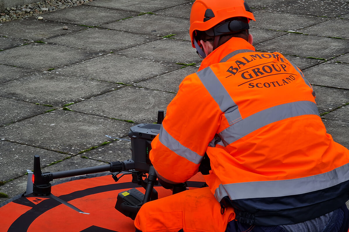
Working at height remains one of the leading causes of serious injury in construction and industrial maintenance, a fact consistently reported in UK HSE statistics. UAV surveys remove the inspector from the equation entirely on many asset types. No access platforms, no rope rigging, no confined space entries, just to gather visual data. For facilities managers carrying Health and Safety Management System obligations, this is not a marginal benefit. It’s a direct reduction in liability exposure and a demonstrable improvement in how you discharge your duty of care.
Data quality and repeatability
Traditional inspections produce written notes and photographs taken by whoever happens to be on site that day. Quality varies, coverage varies, and comparing two inspections from different years is largely subjective. Drone surveys produce georeferenced orthomosaics, calibrated point clouds, thermal data, and HD video. The same flight path repeated on the next inspection cycle makes change detection precise rather than subjective. That quality of data supports better decisions on repair prioritisation and budget allocation, which is where the real financial return comes from.
What drone surveys cost in 2026 and what deliverables to expect?
Understanding the pricing framework before you approach providers is the difference between evaluating a quote and just accepting one.
Typical UK pricing by survey type
Photogrammetry orthomosaic surveys run approximately £195 to £1,500 for smaller sites, scaling to £5,000 or more for large infrastructure mapping. LiDAR drone surveys typically start around £1,200 and scale to £5,000 or beyond, depending on point density, vegetation levels, obstruction, and classification requirements. Inspection surveys covering commercial roofs, facades, and structures generally fall between £1,100 and £2,500 for most commercial assets.
The main cost drivers across all types are: site area, required accuracy, deliverable complexity, urban obstruction density, and the number of GCPs needed to hit specification. A simple roof on an accessible rural site is priced very differently from a complex urban facade surrounded by people and traffic. Urban environments can add 20 to 30 percent to standard rates because of the additional planning, airspace considerations, and flight constraints involved.
Standard deliverables and file formats
A professional drone survey company should deliver the following without you having to negotiate for them. For a comprehensive checklist of common mapping and inspection deliverables, this drone mapping deliverables guide is a useful reference.
Mapping surveys:
- Orthomosaic in GeoTIFF
- DSM and DTM in GeoTIFF
- Point cloud in LAS or LAZ
- Contours in DWG or DXF for CAD, and SHP for GIS
Inspection surveys:
- HD video footage
- Thermal imaging report with annotated findings
- High-resolution photography
- Written defect schedule
Deliverables should open directly in your existing CAD or GIS workflow without reformatting work on your end. If a provider can’t confirm their output formats before the survey day, that’s a red flag.
Turnaround times and what causes delays:
Small site capture typically takes 30 minutes to a few hours of flight time, with processing completed in two to four hours for datasets under 300 images. Larger infrastructure projects require one to two days in the field and several days of processing. Common causes of delay include weather holds, site access restrictions, GCP placement difficulties on complex terrain, and processing bottlenecks on large datasets. Agree on turnaround expectations in writing before the survey day; a reliable provider will give you a realistic timeline and hold to it.
How to choose the right drone survey provider and act on what they find?
Readers who’ve reached this point are ready to commission. Start with credentials, then ask the hard questions.
CAA credentials and insurance: what to verify
In the UK, commercial drone operations require CAA operator registration, a pilot holding a General Visual Line of Sight Certificate (GVC) for professional work, and an Operational Authorisation for complex or Specific Category operations. The GVC stops being issued on 31 December 2027, after which Remote Pilot Certificates replace it, but GVC remains the current standard for 2026 commercial survey work. Insurance should include third-party public liability at a minimum, with professional indemnity and employers’ liability also standard for any serious contractor.
Ask for a verifiable CAA Operator ID, named pilot qualifications, and a current insurance certificate with cover limits clearly visible. For a straightforward explanation of drone licence and operator ID requirements, see this overview of drone licence and operator ID. Industry accreditations such as Constructionline Gold, SSIP, and ARPAS-UK membership indicate a provider operating above the regulatory floor. These aren’t box-ticking credentials; they’re signals that the business has invested in compliance as an operational standard rather than a one-time requirement.
Questions to ask before you commit
- Push any provider on these specifics before signing anything:
- What accuracy guarantee are they offering, horizontal and vertical stated separately?
- How many GCPs do they plan to deploy, and what’s the reasoning behind that number?
- What processing software do they use, and will deliverables come in your preferred CAD or GIS formats?
- How long will processed data be retained, and can you access it again if a dispute arises?
A capable provider answers these without hesitation. A weak one hedges, deflects, or gives you a generic brochure answer. That response tells you everything you need to know before any money changes hands.
Why is survey data only as useful as the response it triggers?
This is where the real operational gap sits. Drone surveys produce detailed findings: defects, moisture ingress, structural concerns, and maintenance priorities ranked by severity. The problem is that some asset owners commission a survey and then face delays coordinating separate contractors to act on each finding. A roofing contractor, a rope access team, and a cleaning company, each brought in separately, each with their own mobilisation cost and programme impact.
The Balmore Group is built to close that gap. By combining drone surveys with rope access inspection, roofing repair, building restoration, and specialist cleaning under one integrated programme, the full cycle from initial survey to completed repair runs through a single provider. One inspection. One report. One contractor that handles everything from survey to sign-off. For complex industrial assets where defects don’t fall neatly into one discipline, that integration is a significant operational and cost advantage, not a convenience feature.

The bottom line on aerial survey services for industrial assets
Drone surveys have moved past being a novelty. They’re the standard for any industrial asset where access is difficult, safety risk is real, or data quality from traditional methods has been inadequate. You now know how photogrammetry and LiDAR differ in accuracy and application, what your budget should look like across all three main survey types, which deliverable formats to insist on, and which credentials to verify before signing a contract.
The real return from UAV surveys doesn’t come from the data itself. It comes from what happens after: the maintenance decisions are made faster, the defects are repaired before they escalate, and the inspection cycles become routine rather than disruptive. Data sitting in a folder is just a cost. Data connected to a repair programme is an investment.
If you’re managing an industrial asset that needs inspection, don’t wait for the next scheduled review cycle. Get a qualified provider on the phone, ask the questions listed in this guide, and move from planning to action. The Balmore Group operates across Scotland and England, delivering fully integrated inspection and maintenance programmes built around aerial survey, rope access, and specialist repair. Call us today and ask for a programme outline specific to your asset.












Quotes & Enquiries
At Balmore, we offer the expertise of four decades in difficult access works including roofing, rope access, industrial cleaning and drone inspection services. Our one stop shop approach to inspection, repair and cleaning has grown through our desire to constantly exceed our clients expectations and offer a service that is far superior to our competitors.
Please fill in the form outlining your requirements and our contract team will be able to provide you with a bespoke quotation for your inspection, repair or cleaning needs.


